

The Geographer Vice President
I feel validated.
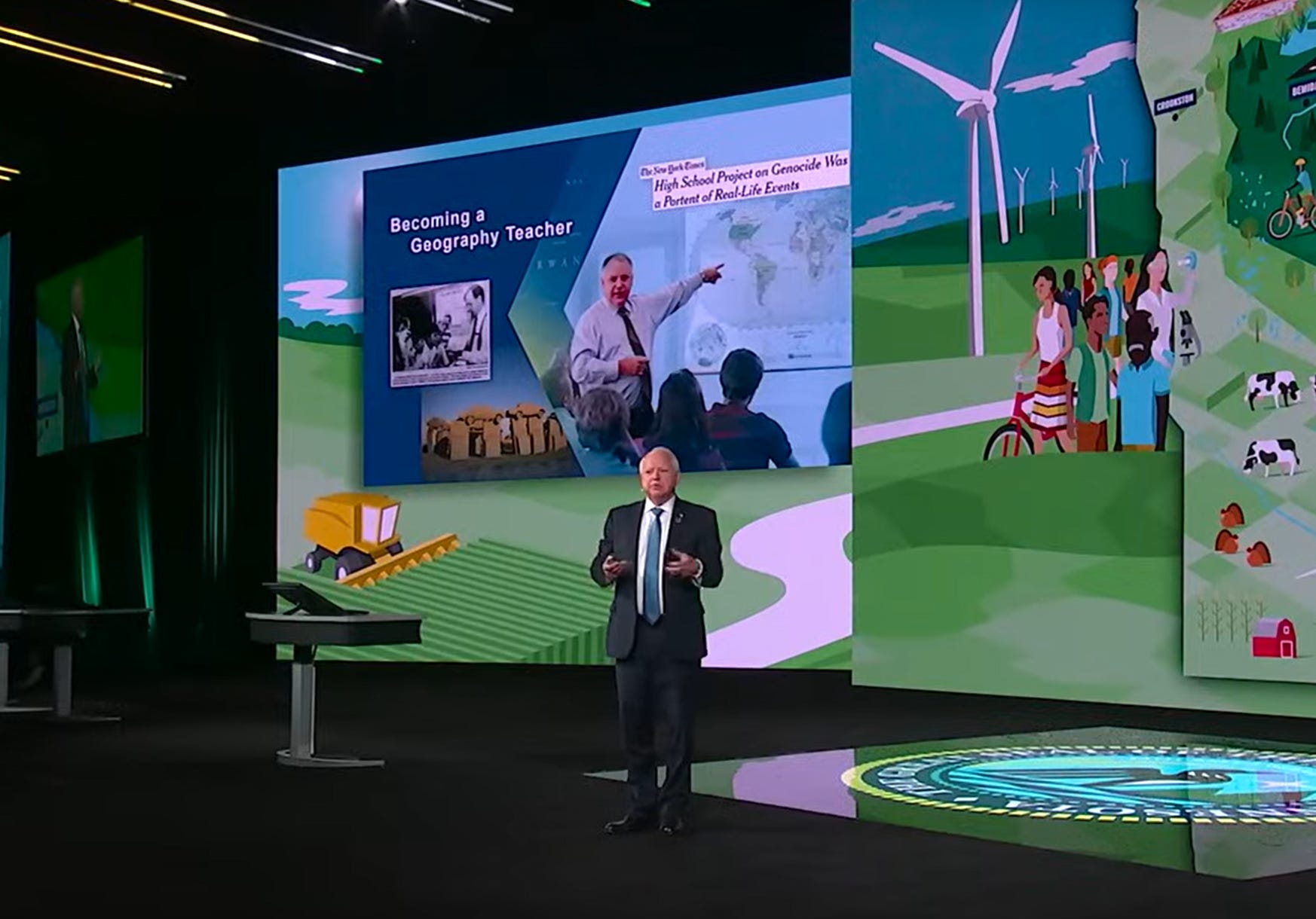
Sorry this is a bit of an aside. Normally, I’d talk about the world and how things interact with each other, but I just have to gush about something: Tim Walz, the 2024 Democratic Vice Presidential candidate, is a geographer, cartographer, and all around map nerd. On top of everything else that’s likeable about the man, this is just about the coolest damn thing to me because, well, geographers don’t often make it that high up in the world!
That’s not to say that geography as a subject isn’t something past presidents, or even very powerful people, don’t engage with regularly. I’d actually argue that one can’t really become a world leader or CEO of a company without being at least a little bit of a geographer. But geography as a subject matter of expertise sort of sinks into the background as compared to say law or medicine, so to see someone who is so proudly geographical rise to the level of potential Vice President of the United States is very cool.
According to the Minnesota Reformer:
Walz said he was an early adopter of GIS software in the 1990s, using it, among other things, to teach high school students about the Holocaust.
He had his students build maps of the contemporary world using different layers of data that scholars believed could factor into modern-day genocides. “They started looking at food insecurity, potential drought, just like the UN was doing around famine early warning,” Walz said.
According to people on Threads, he even gave the keynote at ESRI’s very own User Conference just three weeks ago.
Of course, while having a geographer that close to the president is pretty cool — and validating — this can actually help shape and mold future policy that actually has an impact on things. Too often, in my opinion, statistics are bandied about without relation to the underlying geography that might be containing it. This is all well and good for certain things, but often times they don’t really get to the heart of the matter because, if we start really digging into the spatial data, we might be able to actually see trends that can help us fix some of these problems or at least mitigate them.
Beyond all that, however, simply having a Vice President who is geographically aware of the world will be refreshing! In an age when so many in the United States feel like retreating from the world, or are painfully ignorant of it, having a Vice President who champions geographic education and knowledge will be a great thing, especially if it gets more people interested in understanding why the world is the way it is today.
All of this makes me think of that one episode of the popular 1990s show West Wing (I saw it when I was much older because I was fairly young at the time). In the episode, in case you haven’t seen it, someone caught the attention of the Presidents' chief of staff and introduced them to different maps and how they can portray the world. In particular they compare and contrast the Mercator projection and the Gall-Peters projection. Now I’m not a Gall-Peters-stan personally, I actually think it can be problematic, but the point within the episode was still novel for the time: maps are power and they’ve been used to portray things in specific and subtle ways for centuries.
That could be Tim Walz’s biggest geographic impact on the oval office: simply asking why something is the way it is spatially and then asking the tough spatial questions that might exist around it that non-geographers wouldn’t ever even think to ask. Just like the woman in the clip above never knew to ask whether the Mercator projection was correct or not.
Obviously, nothing dramatic will happen because Tim Walz is a geographer and self-professed map nerd, but it will be nice to know that a geographer is so close to the primary decision maker of the United States should Kamala Harris be elected president come November. And that will be pretty damn cool!
Minnesota Reformer